Mapping and prioritizing
fences for wildlife conservation
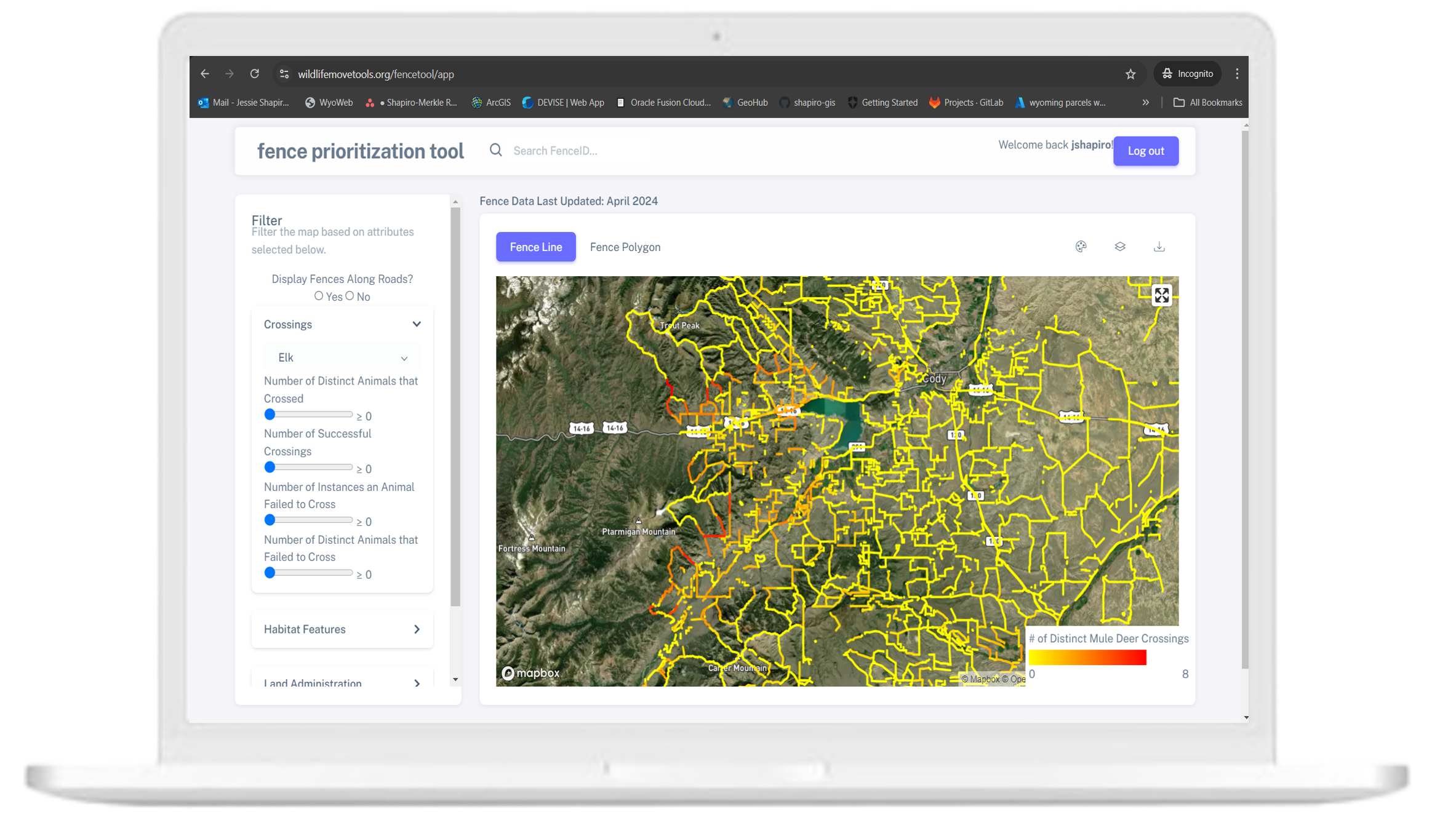
Fences can cause all sorts of problems for wildlife. However, modifying fences to be wildlife friendlier is possible and a win-win situation for wildlife and successful working lands. Mapping fences is a crucial first step to prioritizing fence modification work on the ground. We’ve developed a data collection tool for mapping fence lines, type of fence, wildlife observations, and range improvements using the ESRI ArcGIS Field Maps mobile app. In addition, we’ve developed a durable, flexible, and password-protected database to house and share the data. While we build the app in collaboration with the Absaroka Fence Initiative, Wyoming Game and Fish Department, and other partners, it can be easily scaled to any local entity interested in mapping fences Our data collection fields have been carefully crafted based on previously collected databases by NRCS, USFS, and BLM, as well as the needs of conservation organizations and private landowners.
Fence material, material type, number of wires/spacing, condition, accessibility and urgency.
Type of fence feature (i.e., brace, cattle guard, erosional/watershed feature, gate, natural barrier).
Evidence of wildlife sign interacting with fence (i.e., crossing, carcass, blood, bones, hair, feathers, scat) and the species.
Infrastructure that indicate a rangeland improvement work has taken place, often related to water management (i.e., stock tank, polypipe, salt block).
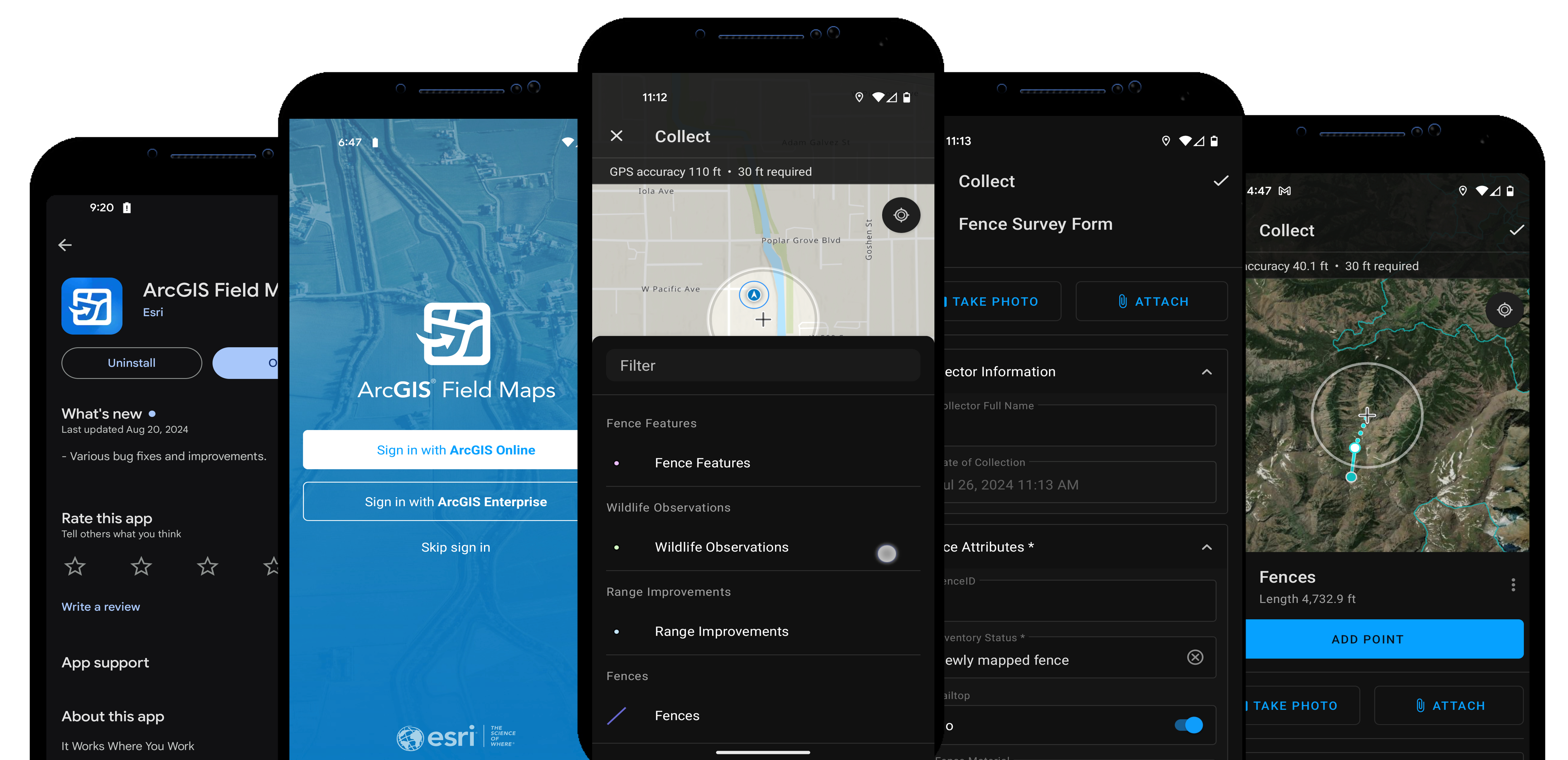
Download the ArcGIS Field Maps app from the App Store (iOS) or Google Play Store (Android). Make sure your mobile device has a stable internet connection during setup.
Open the app and log in using your ArcGIS Online or organizational credentials. Ensure you have access to the fence region of interest.
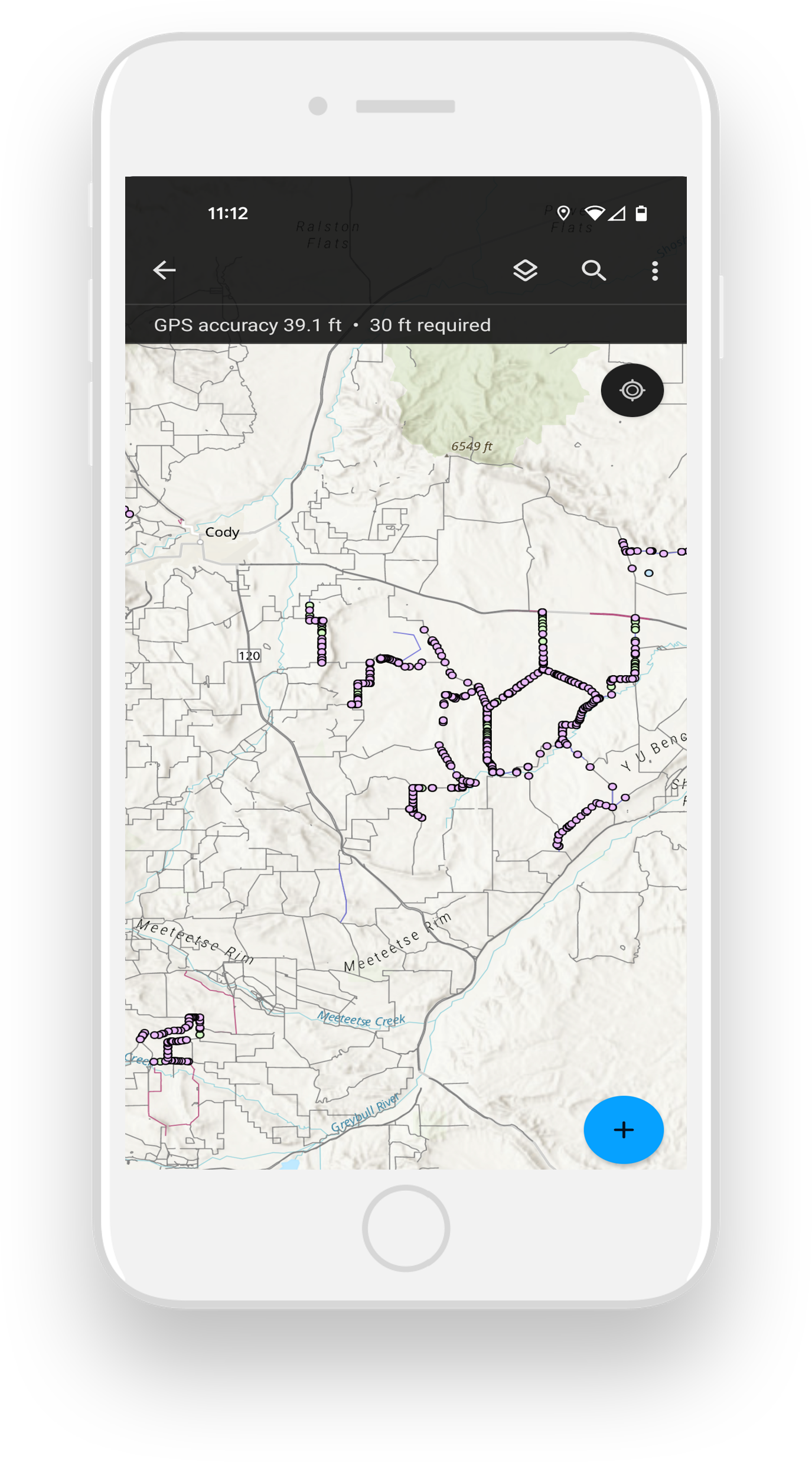
From your available maps, select the appropriate fence map. Wait for the map to load fully, ensuring all layers are visible and ready for data collection.
Tap on the map to choose an existing feature (e.g., fence line) or create a new one by tapping the "+" button. This will open a data entry form specific to that feature.
Fill in the required information for the selected feature, such as fence type and material. Use your device's GPS to capture the feature's exact location, or manually draw its geometry on the map.
After reviewing the data and ensuring the geometry is accurate, tap "Submit" to upload the data. If you're offline, the data will sync once a connection is available.
The schema outlines the fields we collect for each data type, including names, data types, requirements, and examples. You can explore the full details in our Google Sheet
Interact with the map on the right to view fences collected through ArcGIS Field Maps and discover the types of attributes being collected.
Interested in using our app and database? Please contact Jerod Merkle to start the discussion! For more information on data and collection processes, please visit our user-guide.